

U.S. Army Landings at Red and White Beaches
The Sixth Army landings on an 18-mile (29km) front on the east coast of Leyte were the first step in retaking the Philippine Islands. Following a massive pre-invasion naval bombardment and air strikes, Tenth Corps came ashore between Palo and Tacloban. The landing conditions were close to perfect, with clear weather and light surf for the planned attack at 1000 Hours. The seizure of the key objectives of Palo and Tacloban Airfield would guarantee control of San Pedro Bay and the San Juanico Strait. (Note: gridlines are shown at intervals of 1K (0.62 miles).
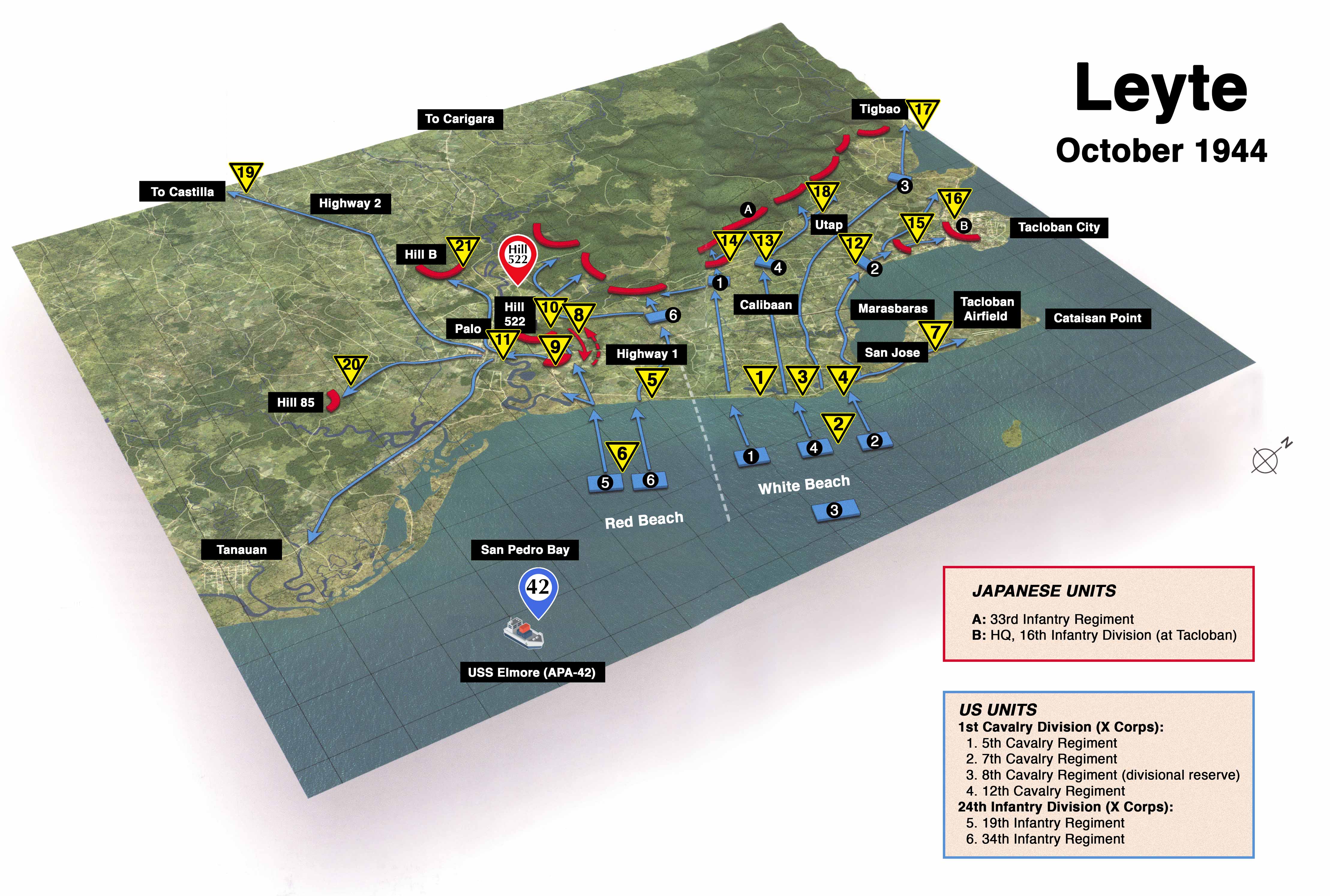

EVENTS
The 3-D Leyte map tells a story by the use of numbered yellow triangles that link a location with an event in time. Pick a number of a yellow triangle (above) and click on the corresponding blue box link (below). A text box will open. The blue numbered boxes on the map are U.S. Army infantry devisions. The red lines are Japanese infantry positions. USS Elmore (APA-42) and Hill 522 are highlighted.
October 20: A-Day
Oct. 21: A-Day+1
Oct. 22: A-Day+2
October 23–26
Source: Leyte 1944: Return to the Philippines
Ospry Publishing, Campaign 282. 2015
By Clayton Chun
Illustrated by Giuseppe Rava